The Dieng Plateau, or the The Dieng Volcanic complex, consists of two or more stratovolcanoes and more than 20 small craters and cones of Pleistocene-to-Holocene age over a 6 x 14 km area. There are
numerous surface manifestations of hydrothermal activity, including lakes, fumaroles/solfatara and hotsprings. The last magmatic (as of 2019) eruption, thought to have occurred in the Dieng Volcanic Complex was at the Pakuwaja cone, during a eruption in 18th Century.The area is also known for the development of geothermal resources and lethal outbursts of gas. Scattered temples are the witnesses of the ancient Hindu culture that once reigned.
References/source used in this article:
-Crater lakes of Java: Dieng, Kelud and Ijen, Excursion Guidebook IAVCEI General Assembly, Bali 2000
-Eruptive History of the Dieng Mountains Region, Central Java, and Potentian Hazards from future Eruption. Open-File report 1983. USGS/PVMBG.
-PVMBG – Center for Volcanology and Geological Hazard Mitigation
-Global Volcanism Program.
-Evaluation of initial investigations Dieng Geothermal Area, Indonesia (USGS, 1971)
Pagerkandang cone
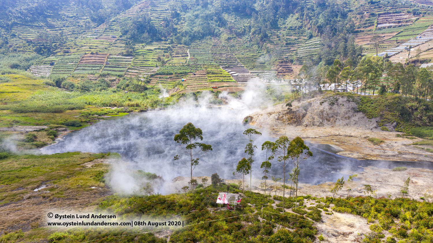
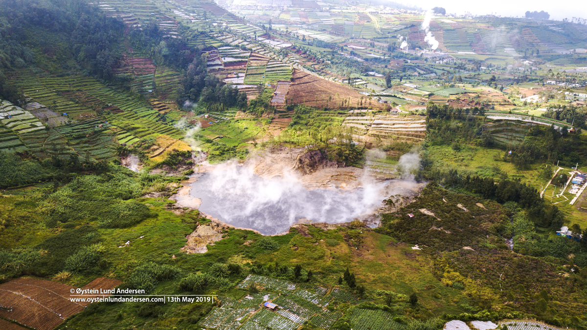
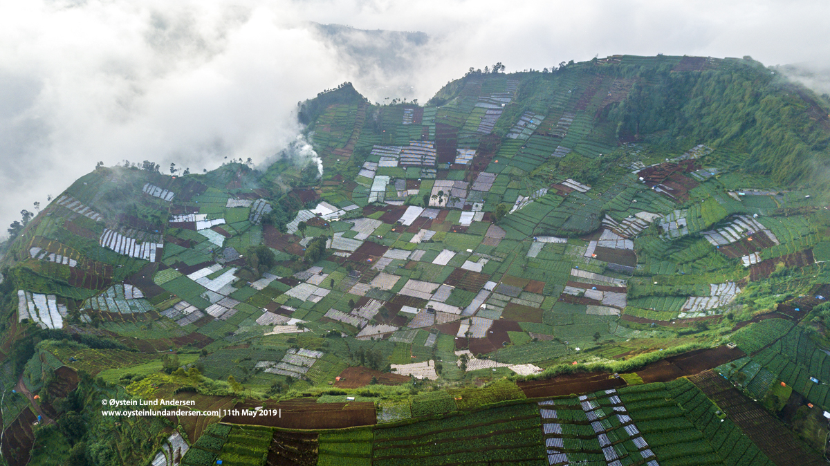
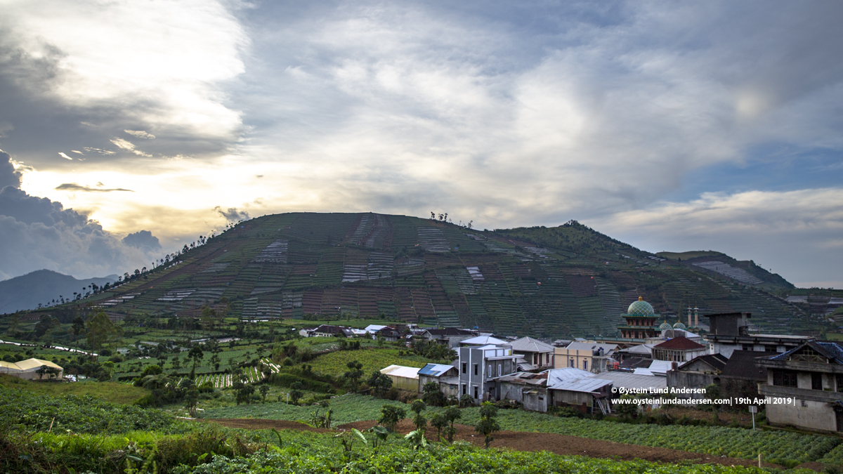
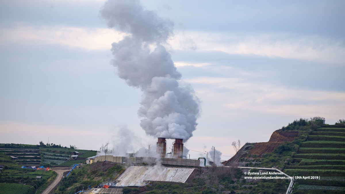
Pagerkandang (sometimes also written Pager Kandang) is a old volcanic cone, situated immediately East of the active Sileri crater. The old cone is today utilized as farmlands, and a road and houses are also found within its crater. One or more geothermal plants is also located on its slopes. Fumaroles have been observed within its summit crater. The active Sileri crater is found on the Western flank of the cone, below what seems to be a landslide/collapse scar. The Sileri crater may be a parasitic crater of Pagerkandang. Another landslide/collapse scar is also located further North on the old cone of Pagerkandang.
References:
–IAVCEI General Assembly Excursion Guidebook, 2000.
-Crater lakes of Java: Dieng, Kelud and Ijen, Excursion Guidebook IAVCEI General Assembly, Bali 2000
-Evaluation of initial investigations Dieng Geothermal Area, Indonesia (USGS, 1971)


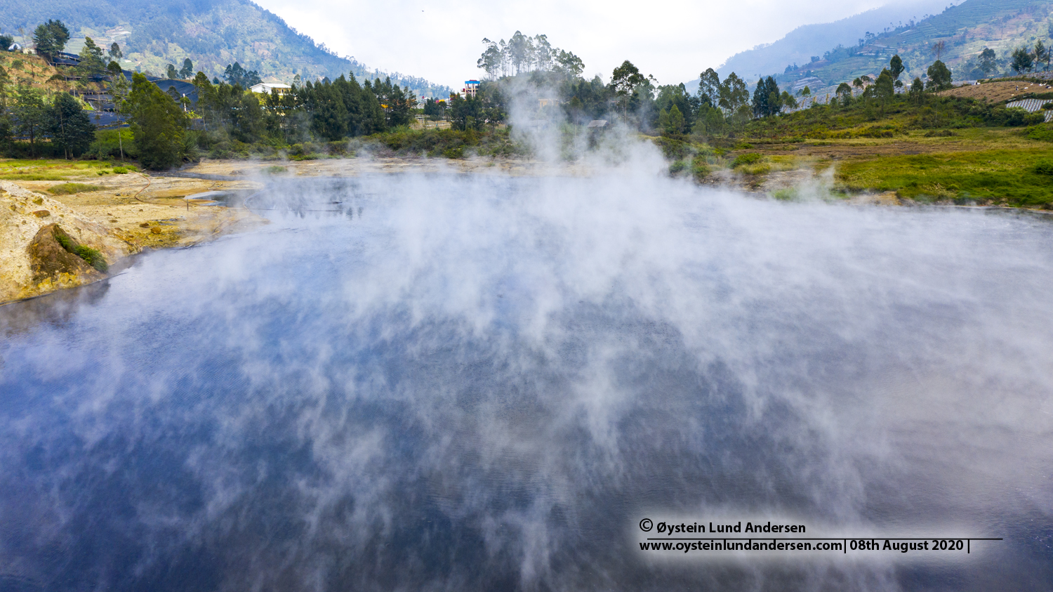
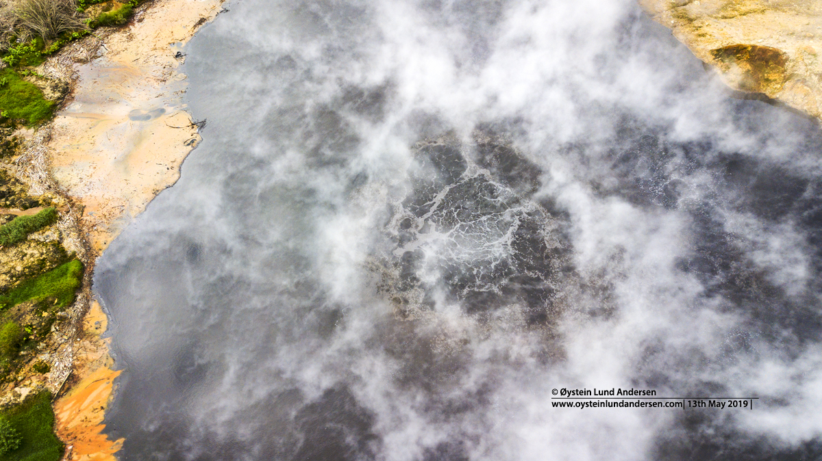
Sileri Crater
Kawah Sileri (sometimes spelled Seleri) last erupted in April 2018 (as of May 2019). A eruption from Sileri killed 114 people in 1964, according to the Global Volcanism Program. A eruption that occurred in 1944 claimed 59 lives, according to PVMBG. Villages of Kepakisan, Sekulan, Sidolok, Pagerkandang, Guadjamungkur and Kepakisan-Lor covered with fine debris (to depth of 1.5-2.0m in Guajahmungkur). Blocks thrown to 1km. Other eruptions: 1956, 1964, 1986, 2003, 2009, 2017.
Source: -EVALUATION OF INITIAL INVESTIGATIONS DIENG GEOTHERMAL AREA, INDONESIA (USGS, 1971)