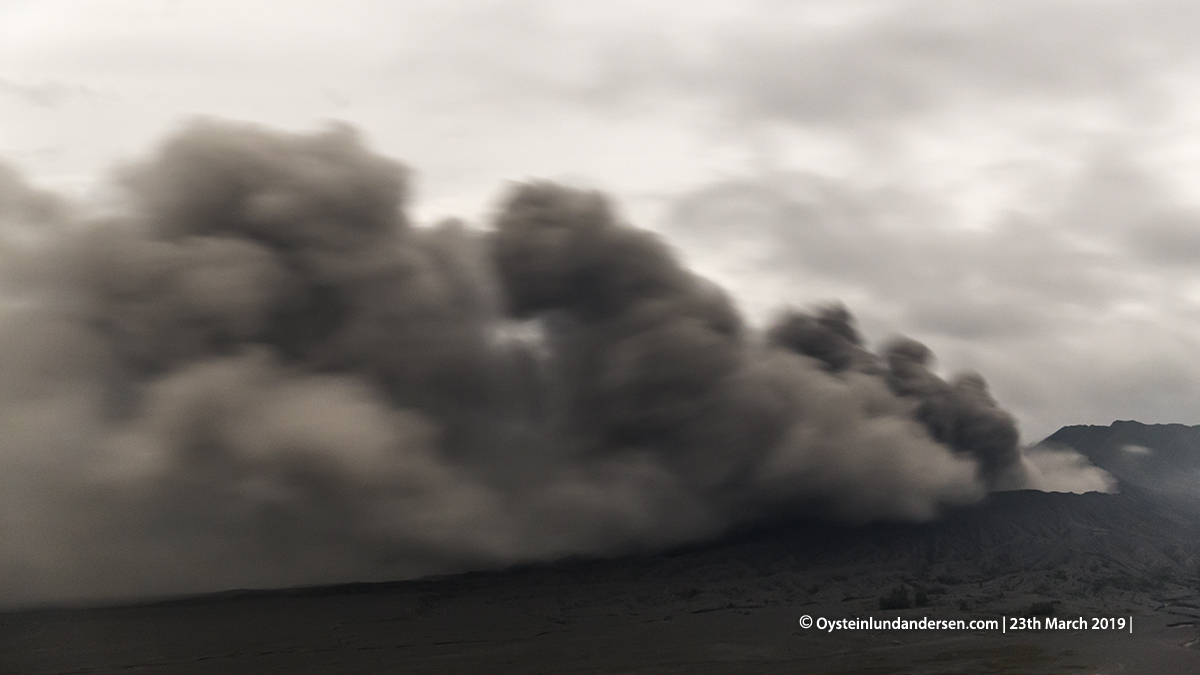
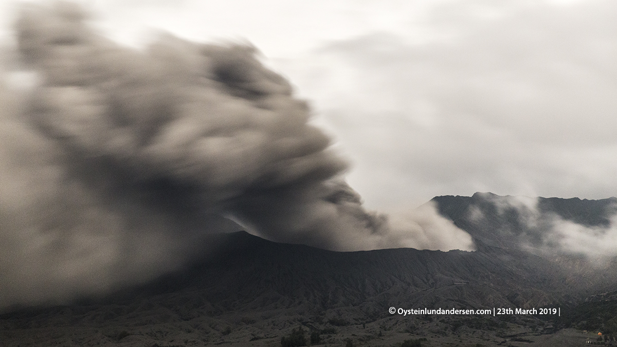
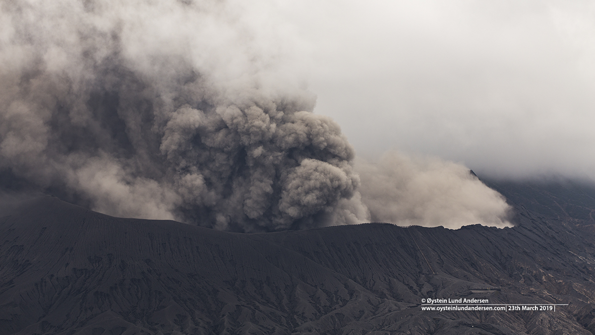
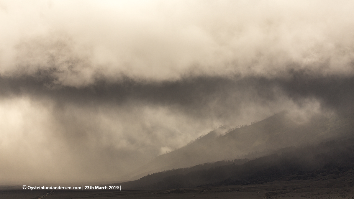
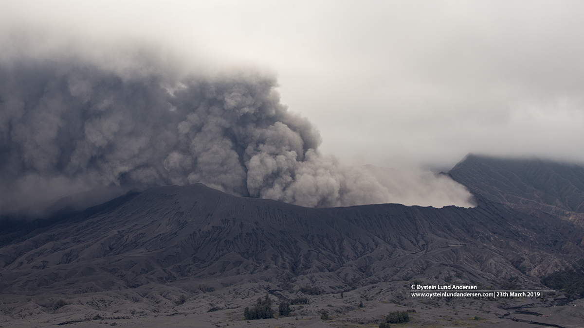
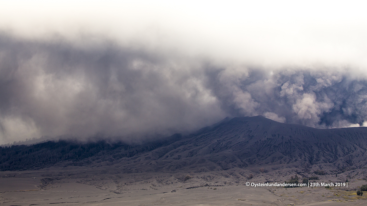
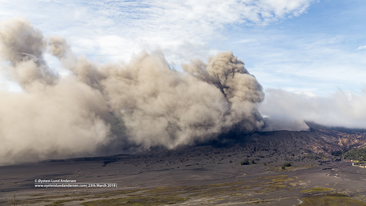
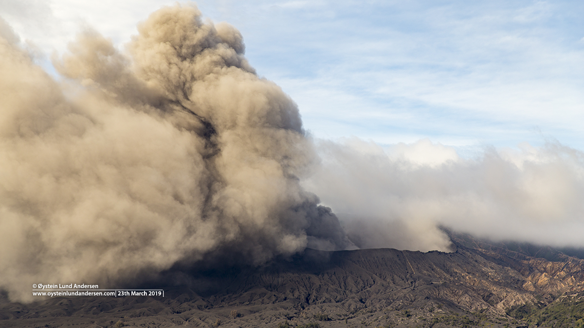
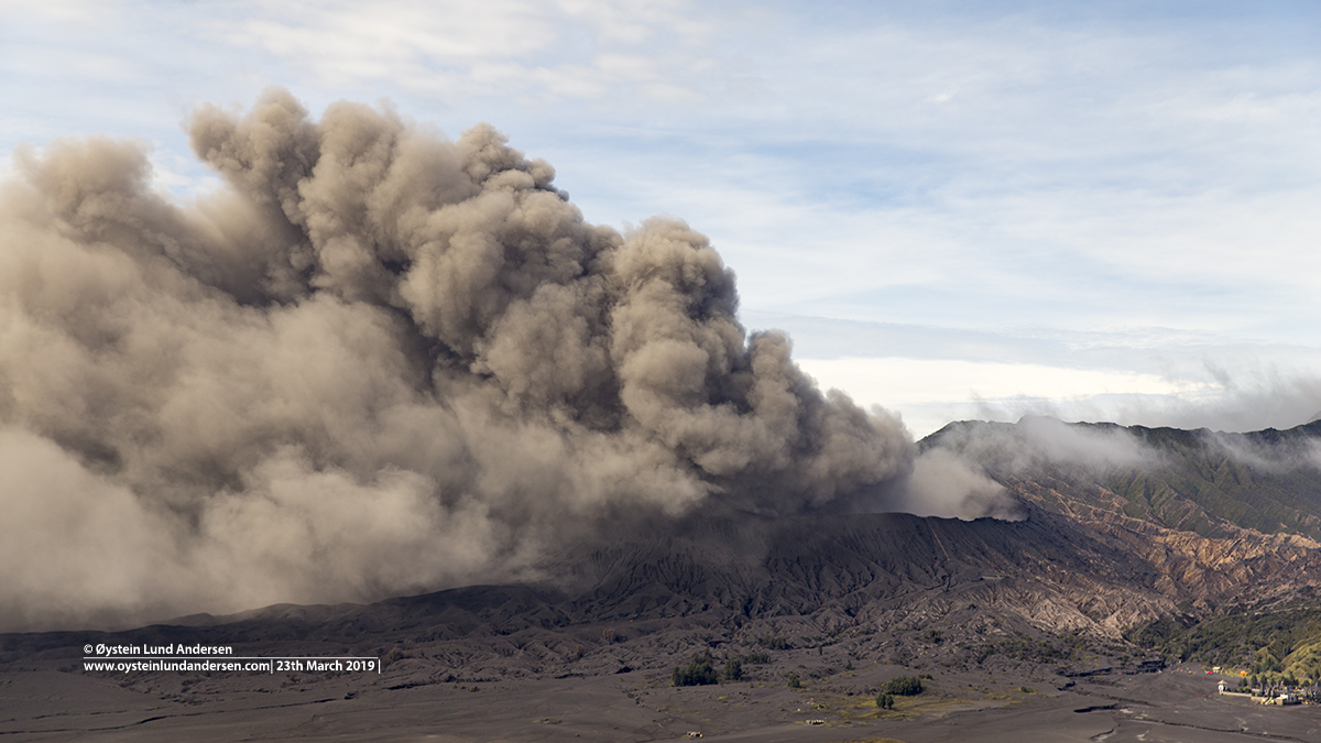
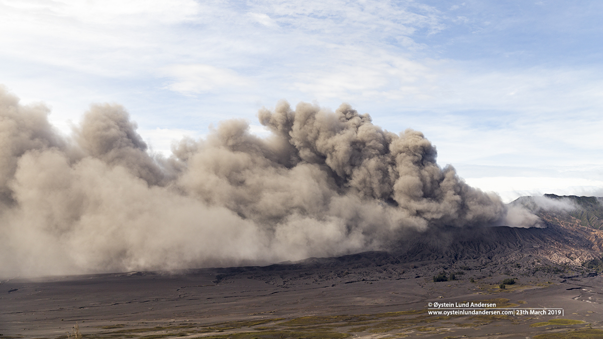
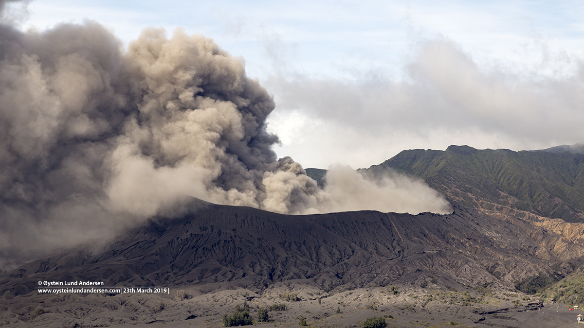
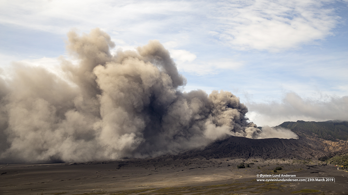
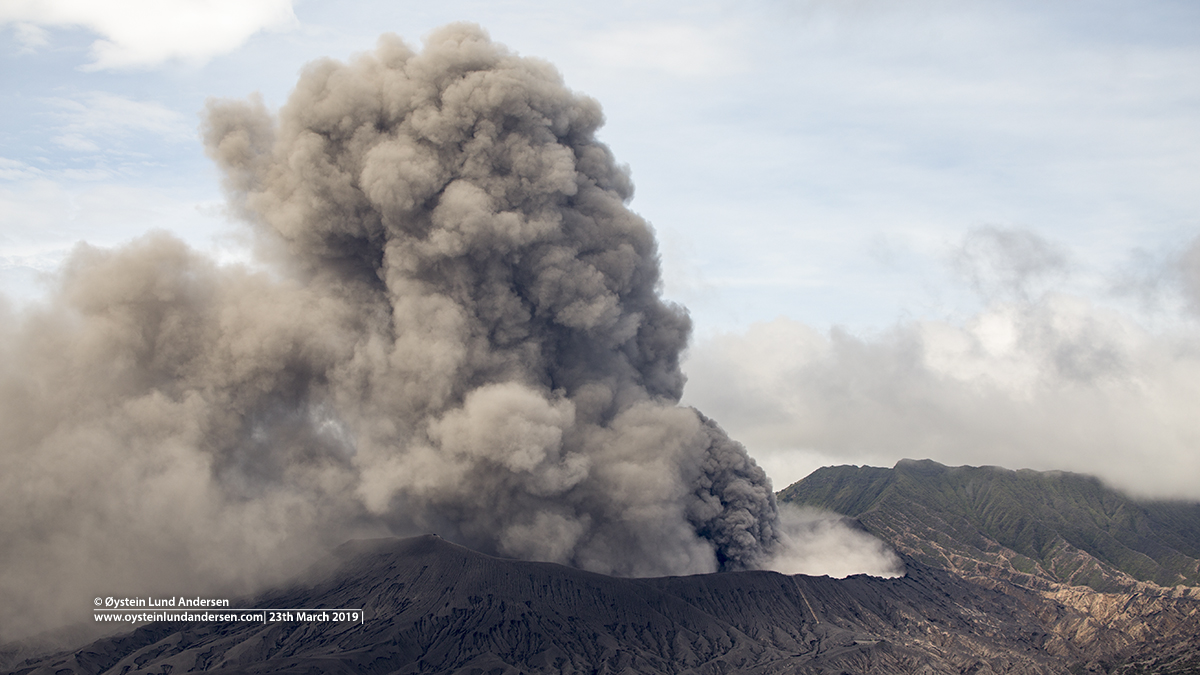
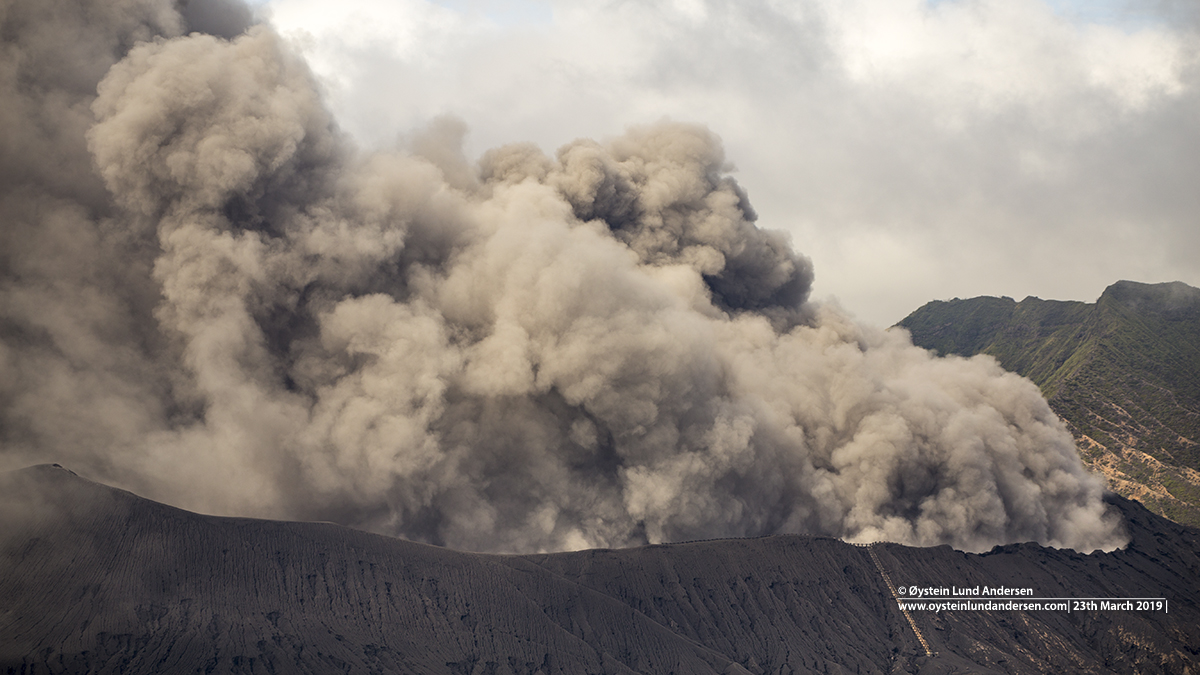
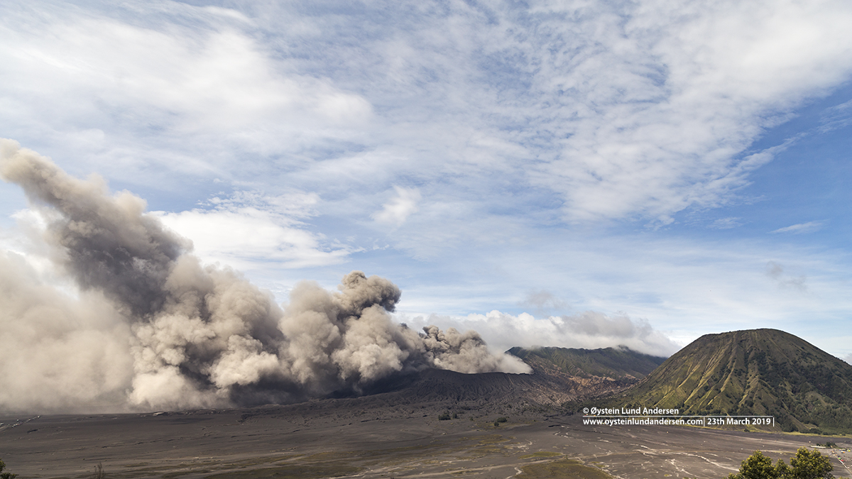
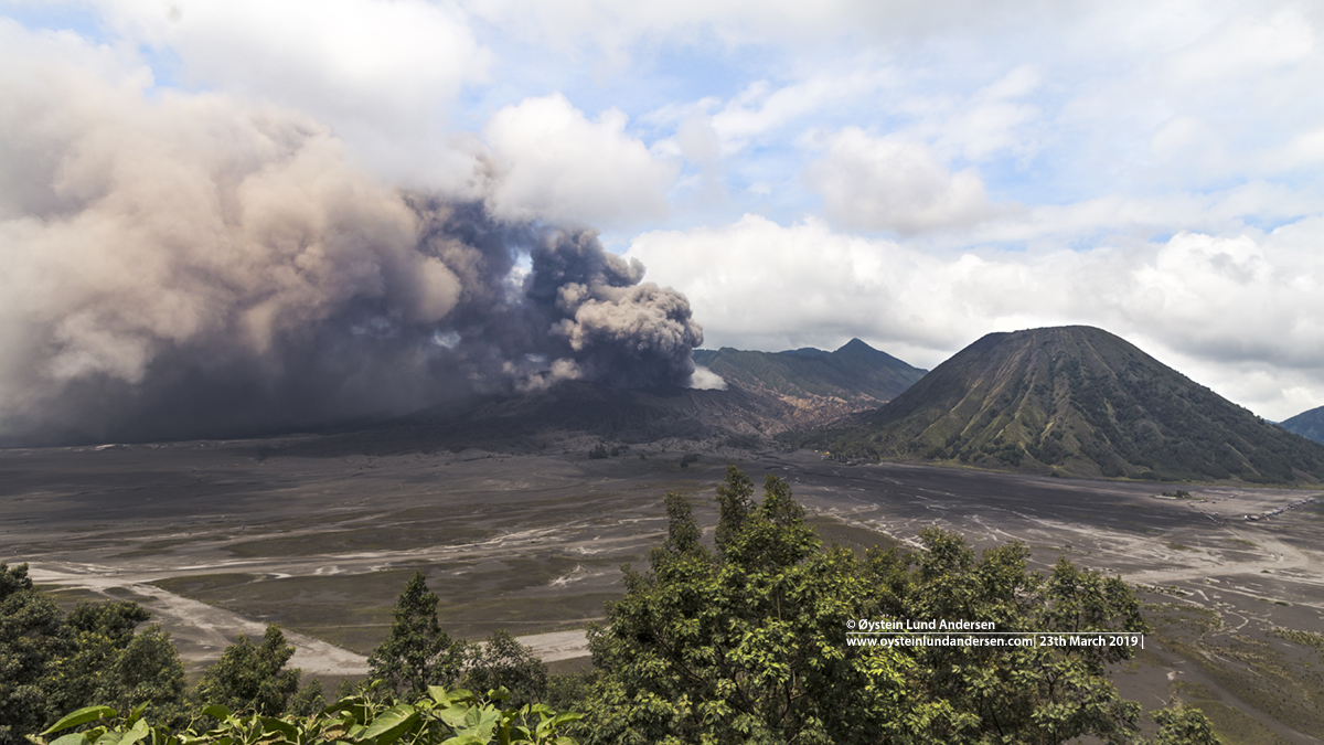
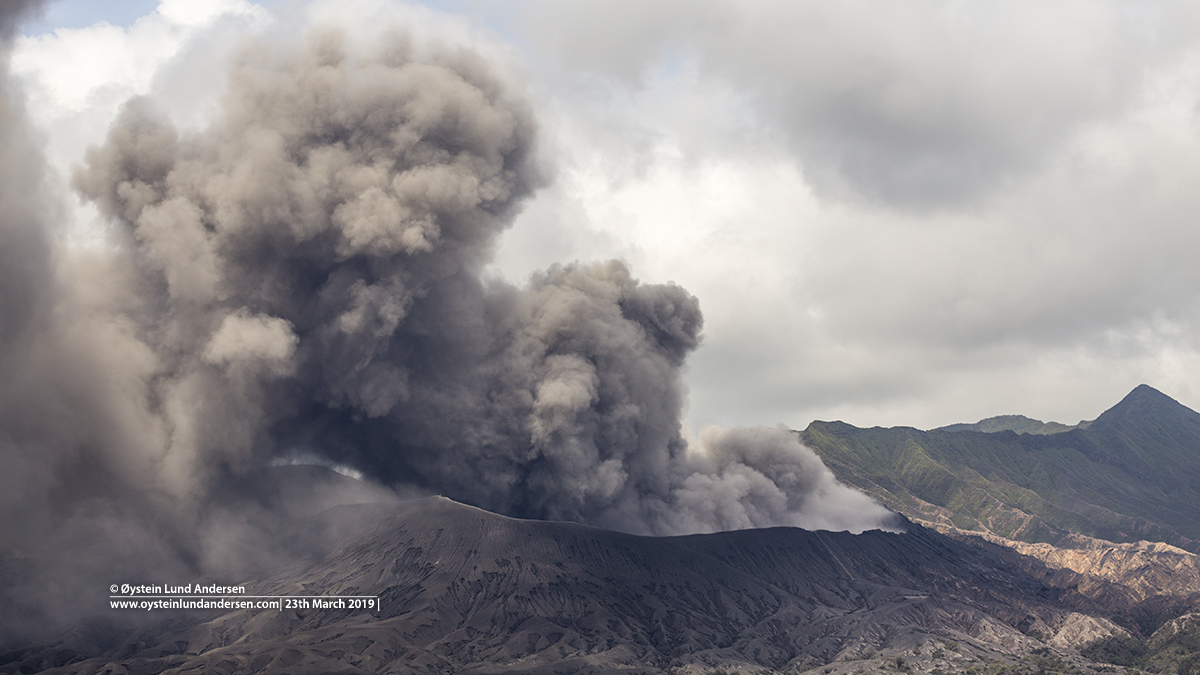
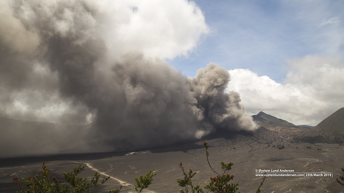
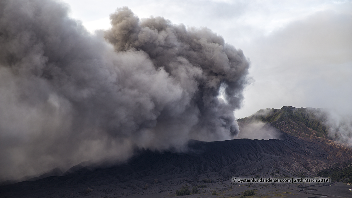
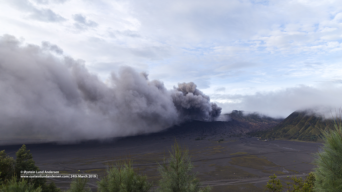
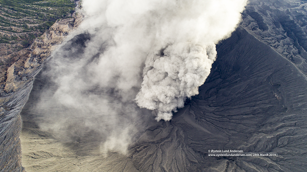
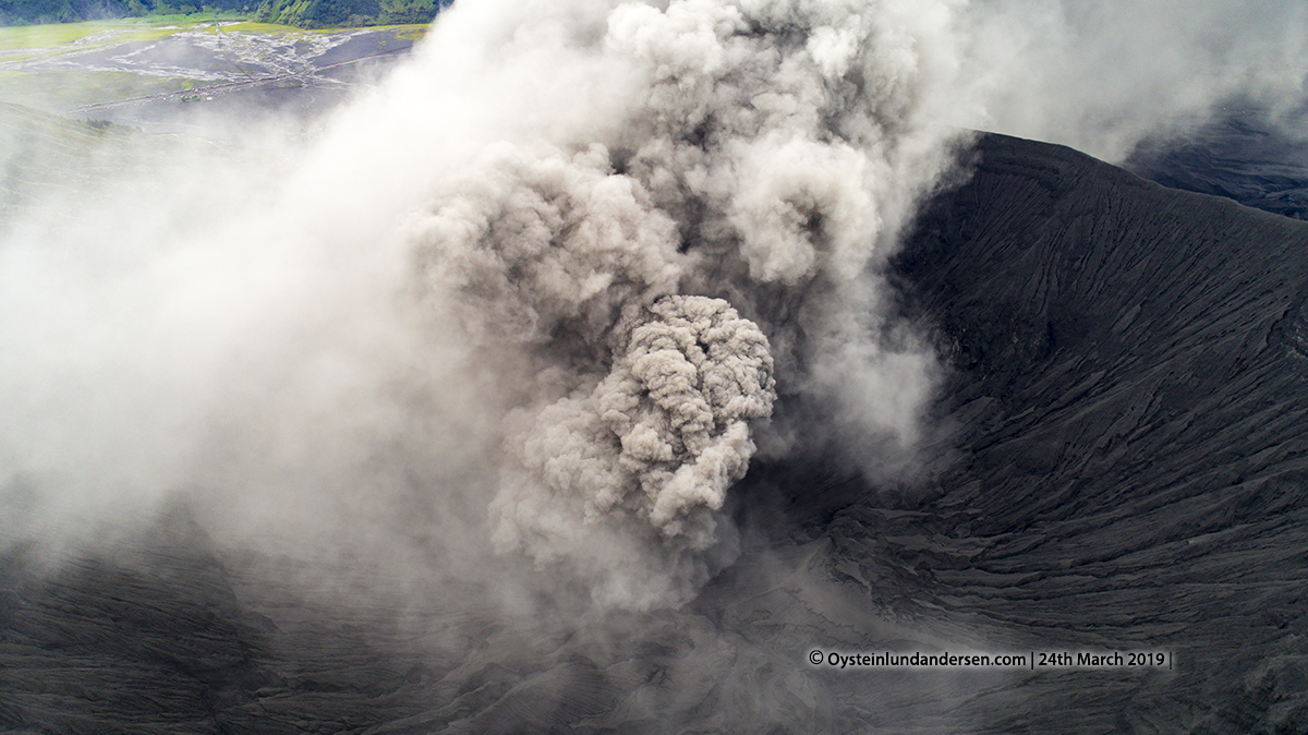
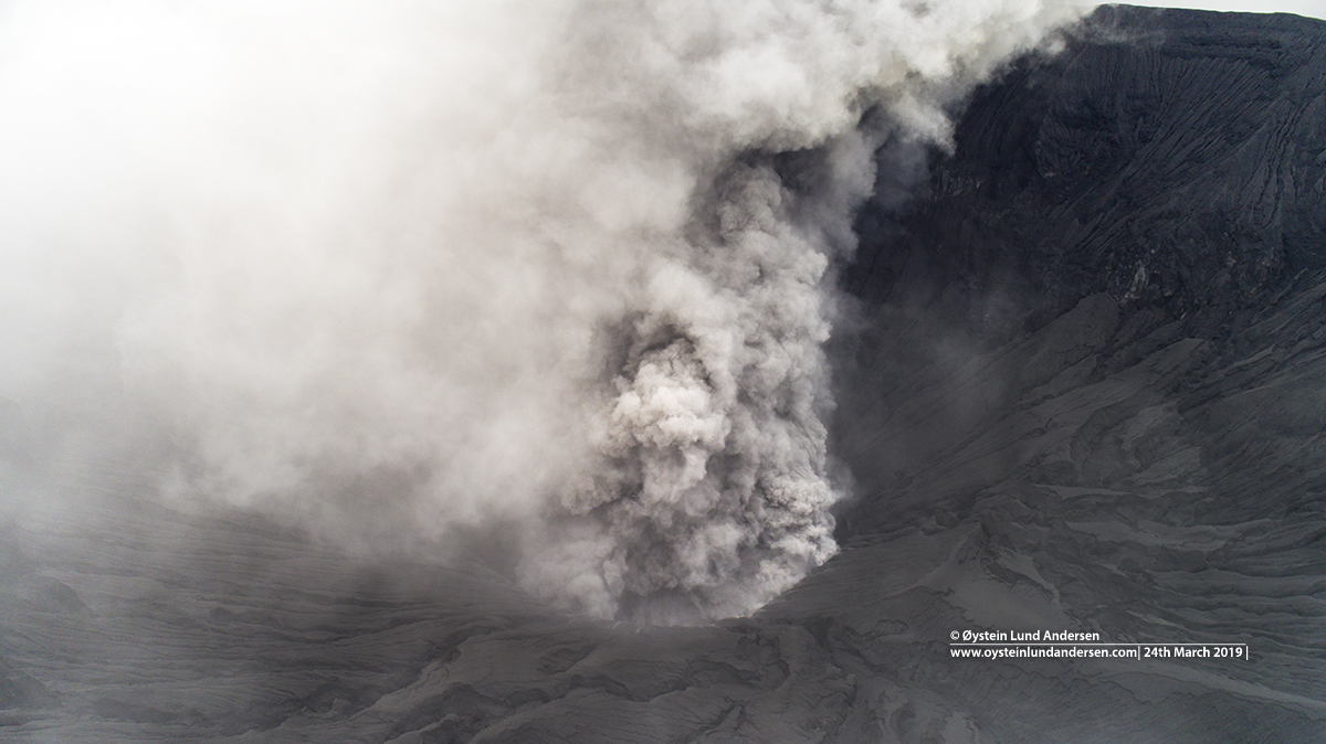
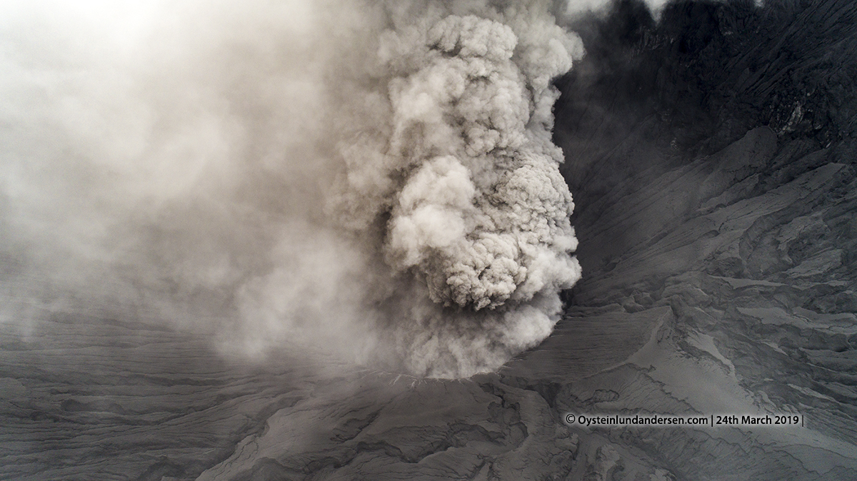
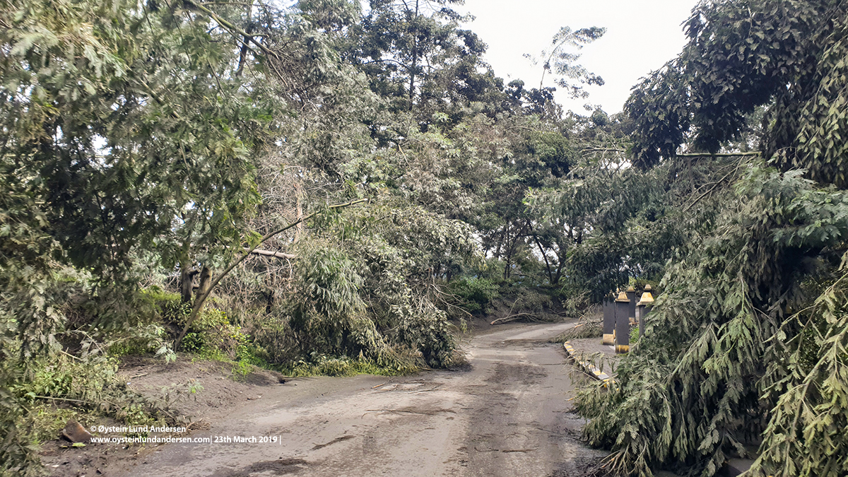
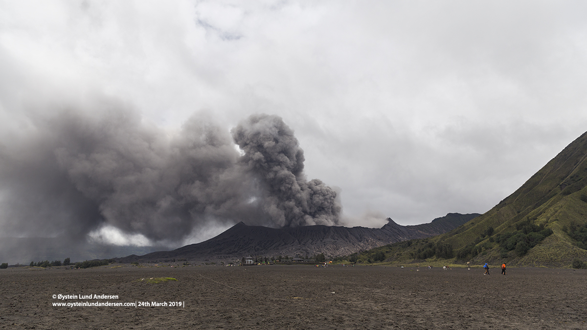
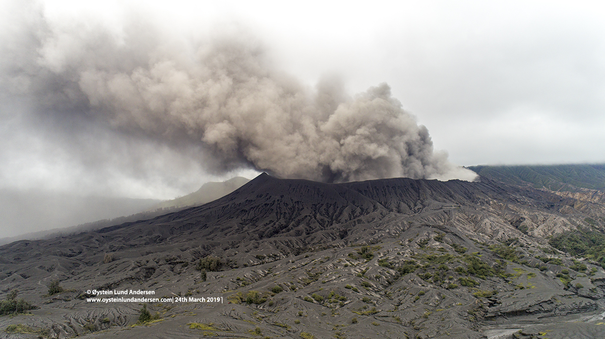
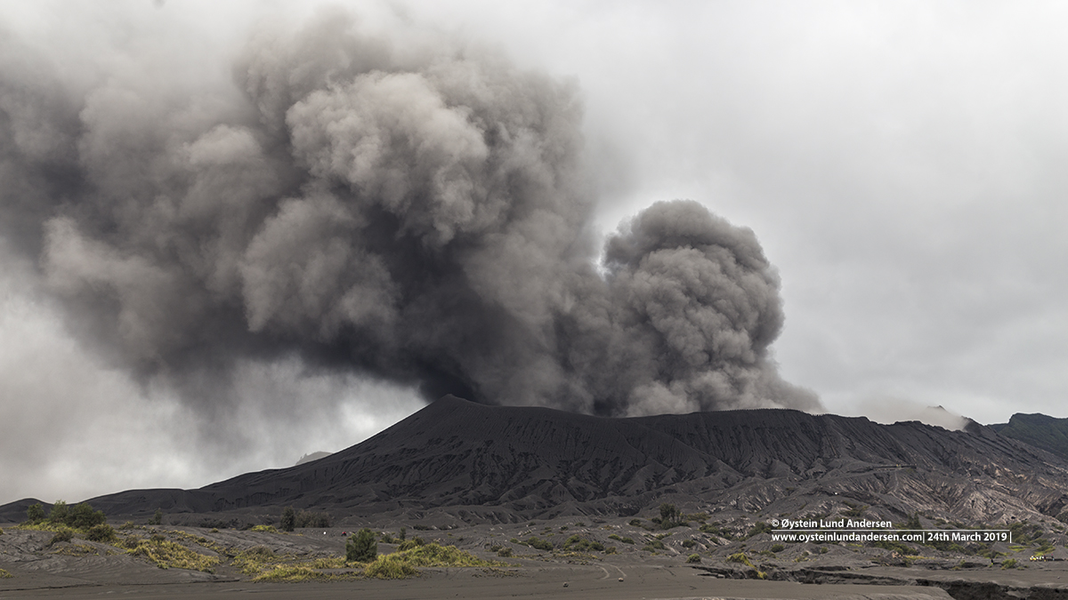
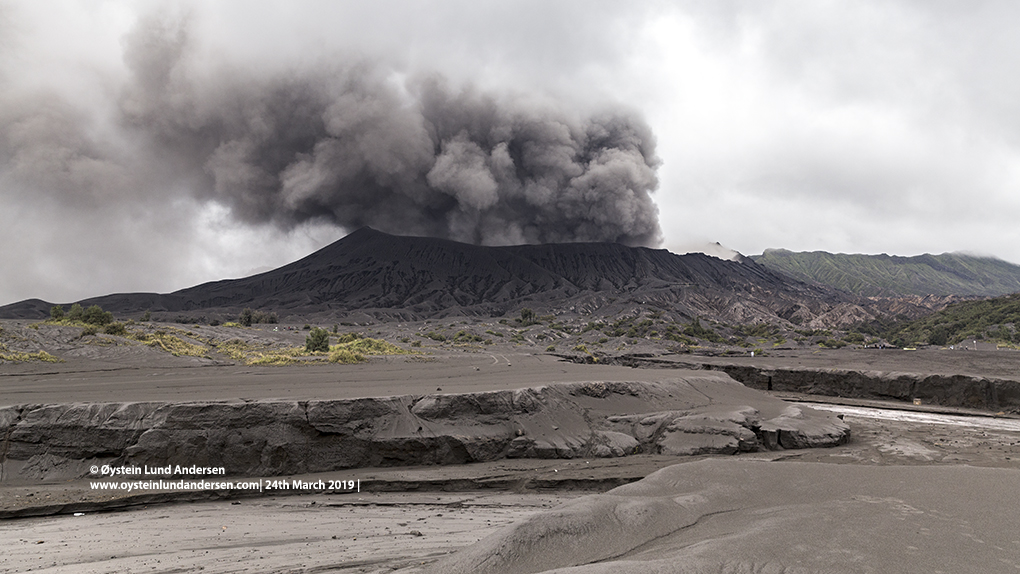
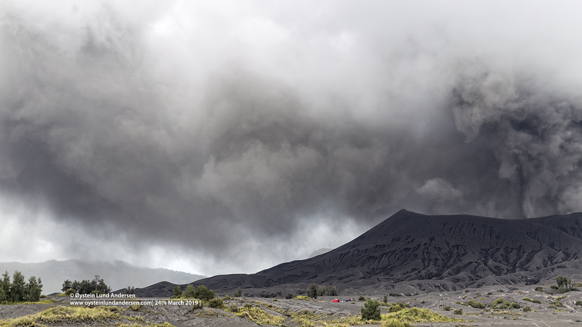
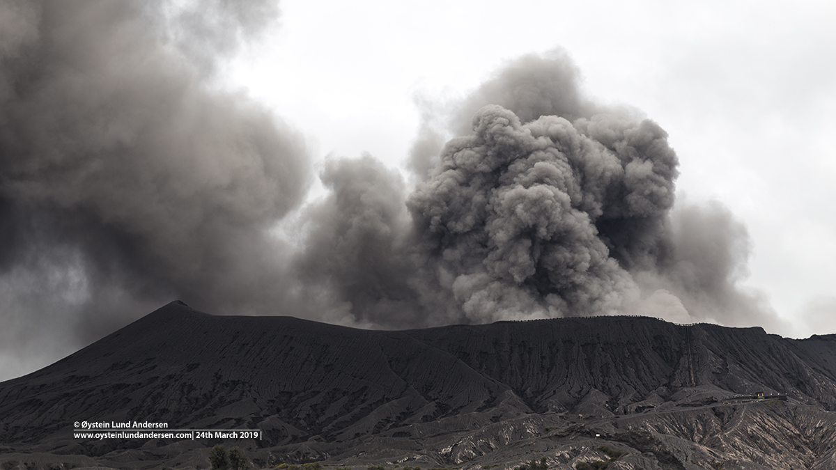
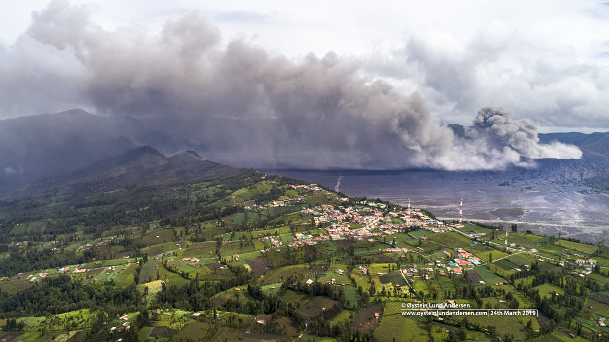
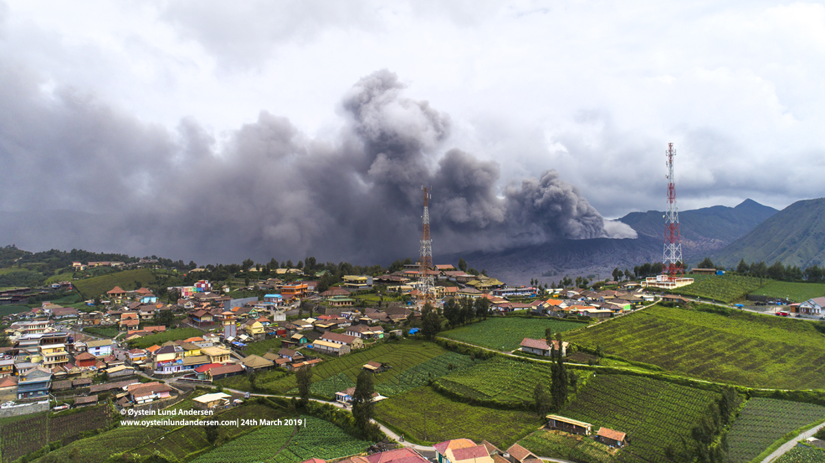
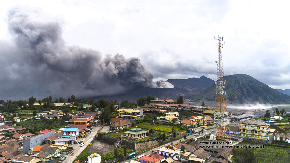
The eruption produced a almost continious grey ash-rich plume. The ash plume was reported by Indonesian Authorities (PVMBG/MAGMA) to be reaching heights between 600-900 above the crater during the period 23-24th March. Ash could be seen falling in areas under the drifting plume (see for example photo no.7, 43 & 45). The ash plume was heading in a N/NE direction. It was obvious that ash had impacted the closest villages to Bromo, among others Cemara Lawang. The ground in Cemara Lawang was covered by a thin layer of ash. Some trees in the area had been toppled over by the weight of the recent ash-fall (see photo no.33). No rumbling sounds from the eruption were heard or lava-glow from the crater were observed.
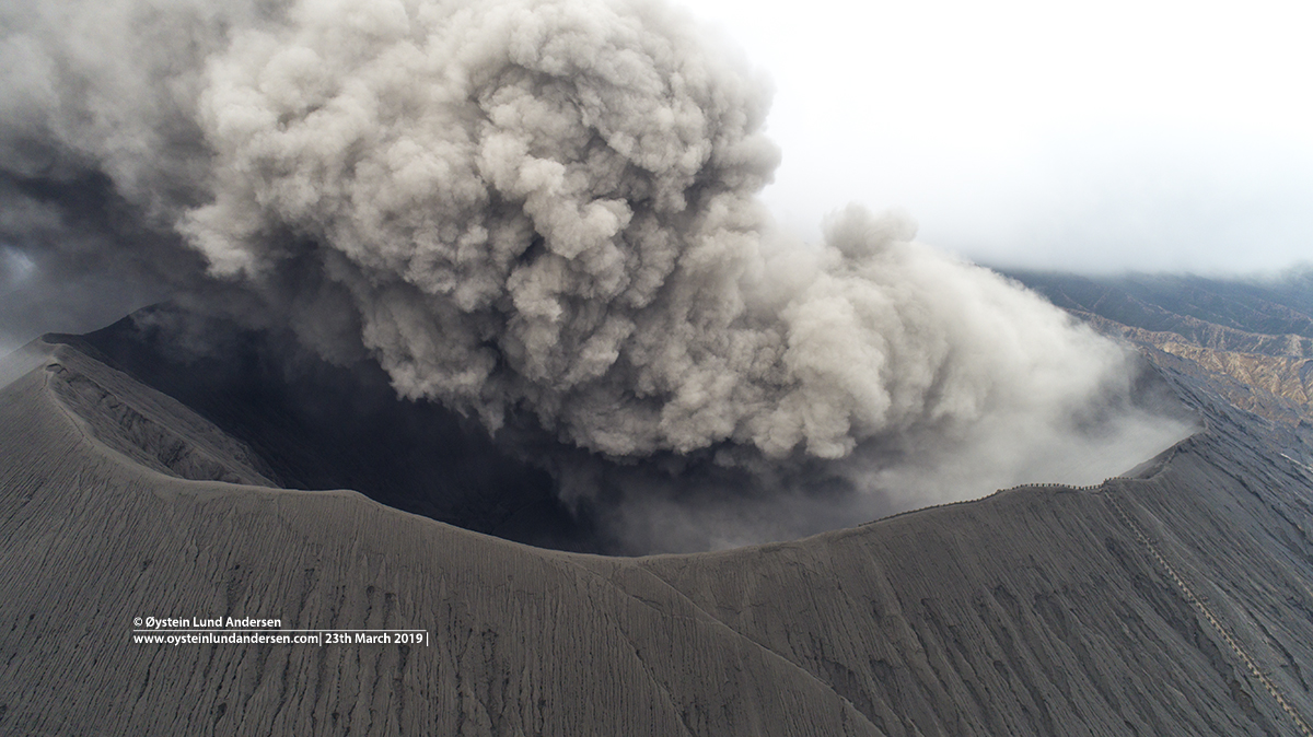
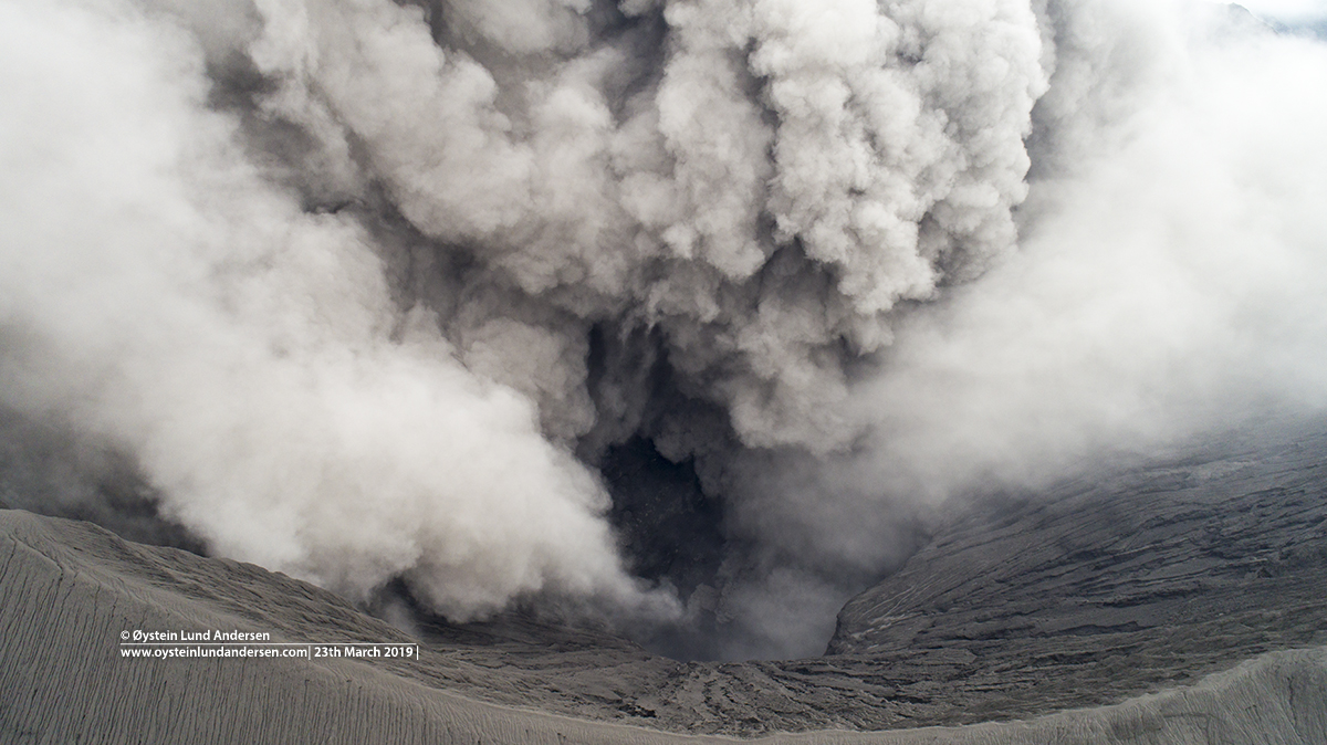
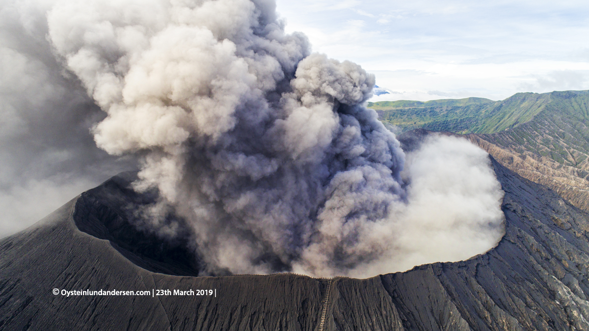
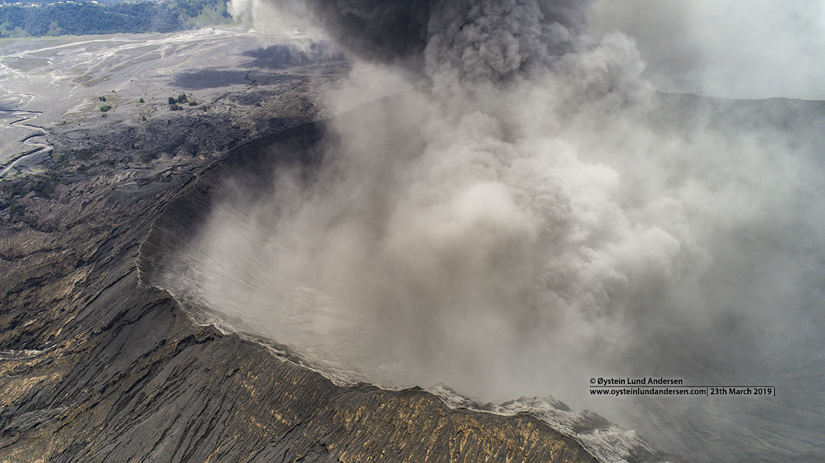
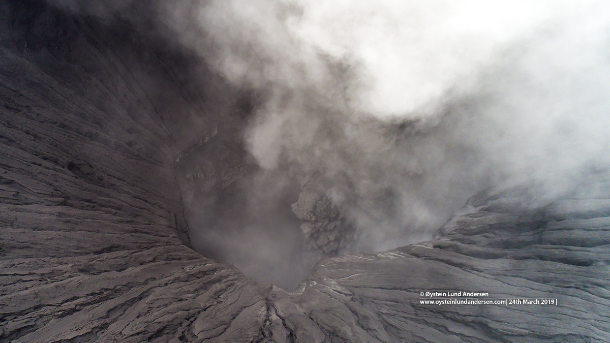
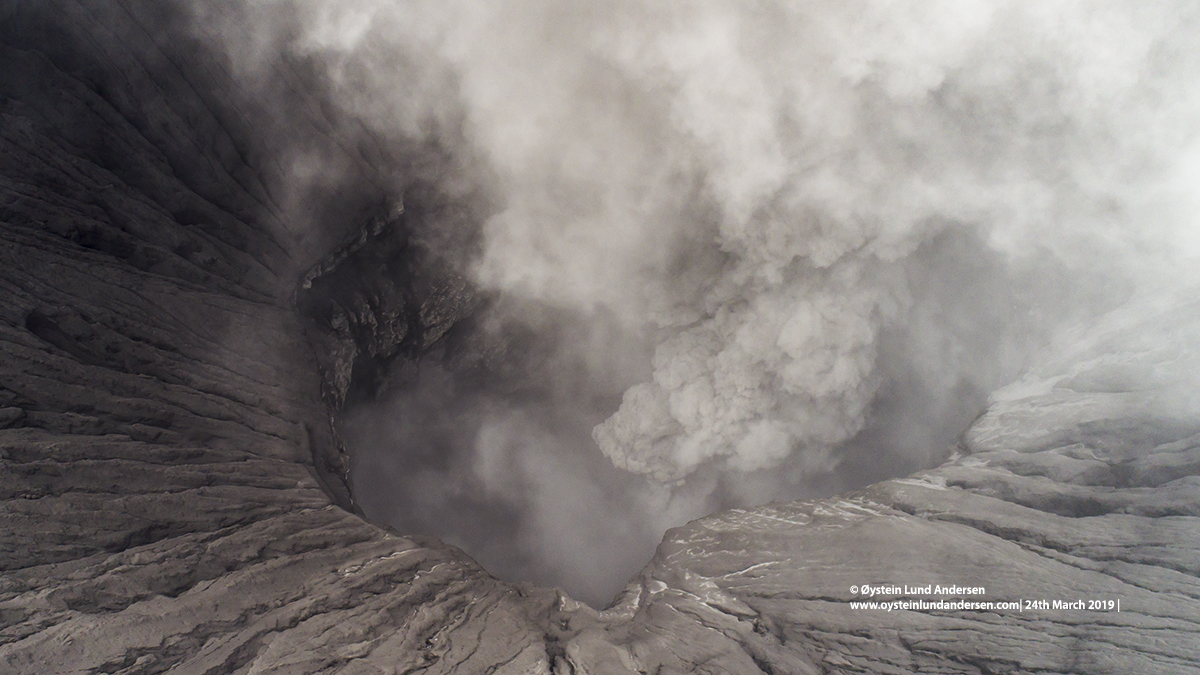
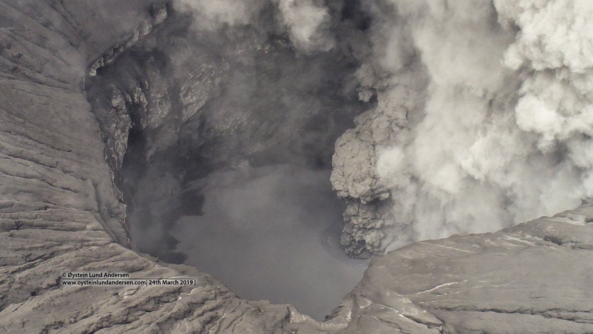
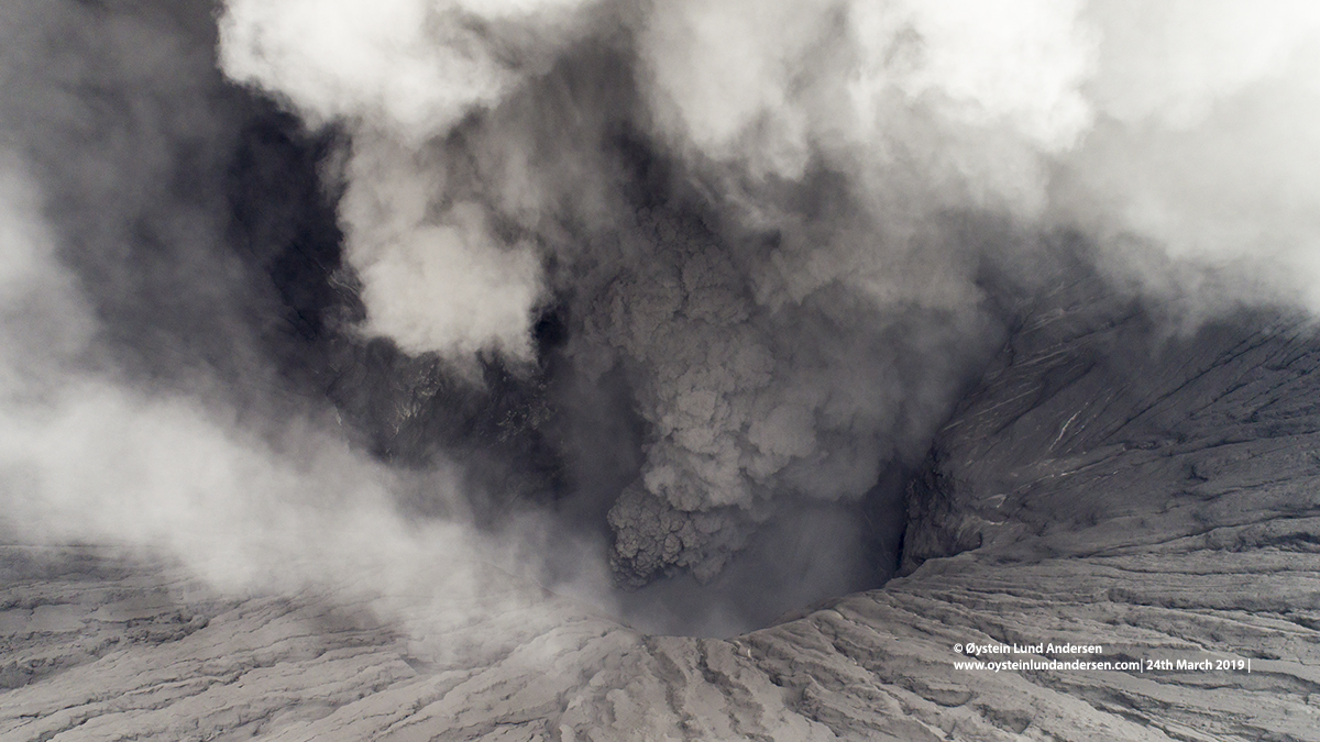
With a drone, I were able to observe the crater on both days I stayed in the area. Examining the photos, it seem that ash were eruped from one or more fissure(s) located within the central part of the crater (see for example photo no.39, 41 & 42). The fissure(s) are not visible/exposed, as the floor of the crater is now covered with freshly accumulated grey ash, that seem to be mixed with water. (During my previous visit in December 2018, the crater were more exposed, as yellow sulfur stained rock and multiple fissures emitting white gas (steam) were observed.). It is now rainy season in East-Java, this fact may explain why water have accumulated and mixed with ash in the crater.
Important Note:
This is my personal notes, and should not be considered as official information regarding the volcano or its activity. For updated information and official statements on the volcanic activity of Bromo, visit the Indonesian authorities website MAGMA Indonesia.andCenter for Volcanology and Geological Hazard Mitigation`(PVMBG)andBMKG –Indonesian Agency for Meteorology, Climatology and Geophysics.On Twitter:@id_magma , @vulkanologi_mbg and @infoBMKG
Bromo is currently (as of 28th March) on alert level II, and Indonesian Authorities have imposed a restriction/danger-zone of 1km from the crater. Visitors and the community is expected to keep out of the restriction/danger zone.
Note: All photos were taken from outside the 1km restriction zone. The aerial photos taken by drone, operated from outside the restriction zone.
____________________
Total photos in this article: 49. (Available in Jpg/Raw.)
Total videos: will be added later. (4K resolution)
Photos and Videos published are available for purchase. For more information please seethis page
____________________
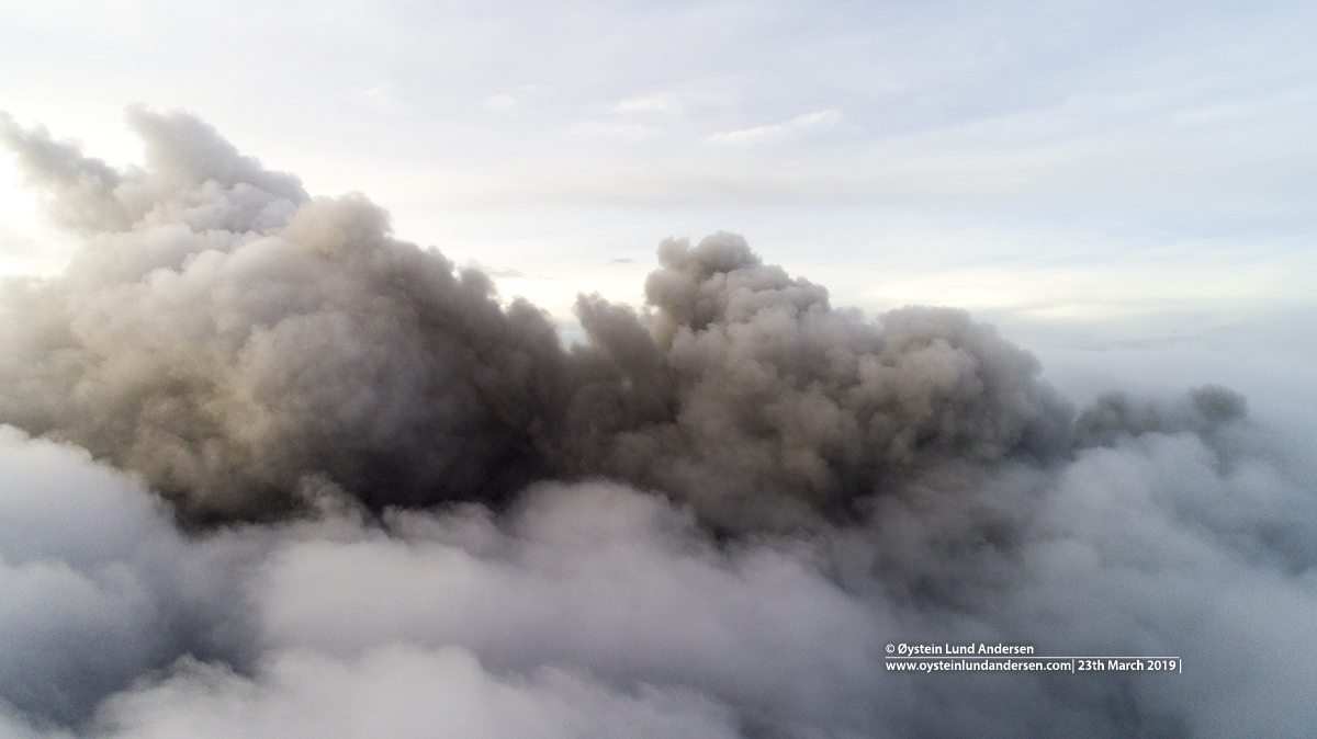
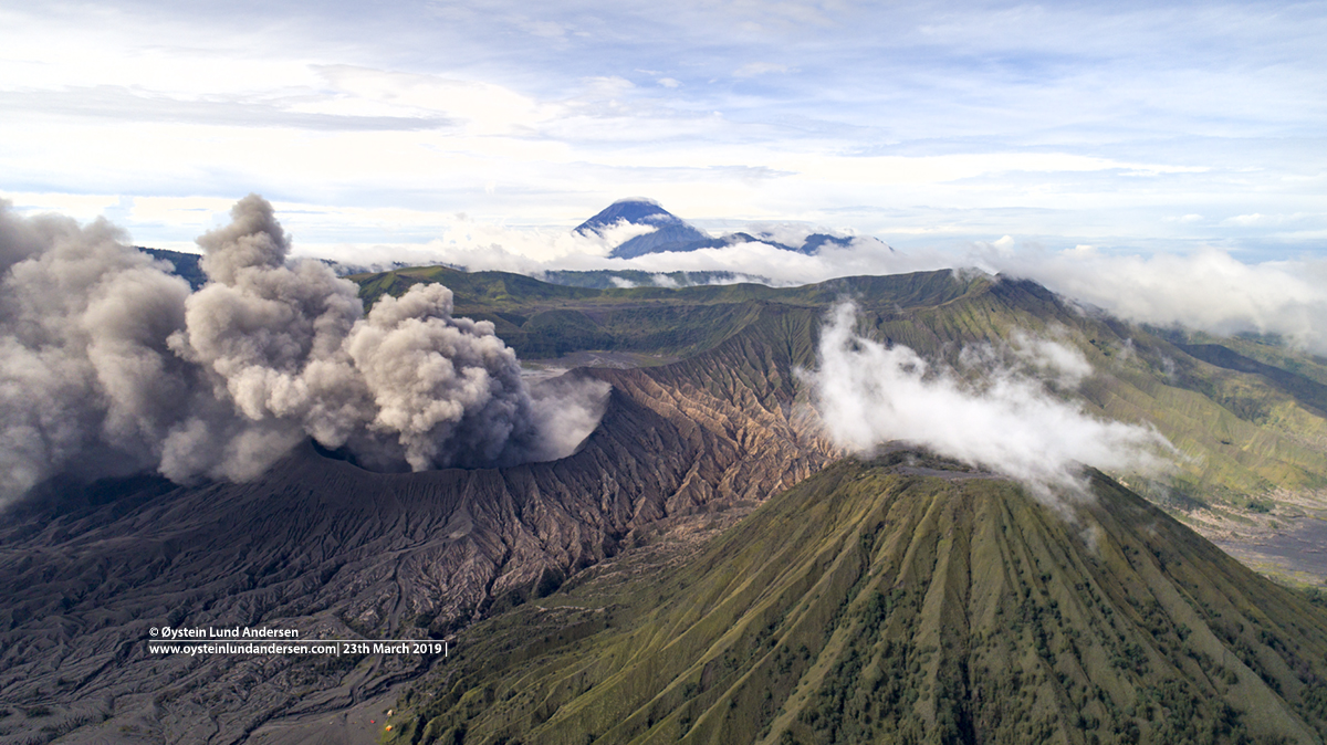
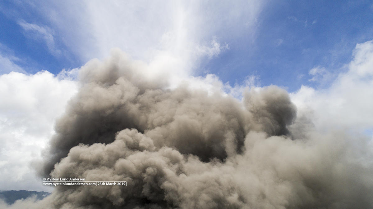
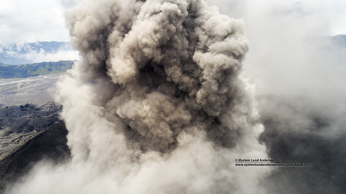
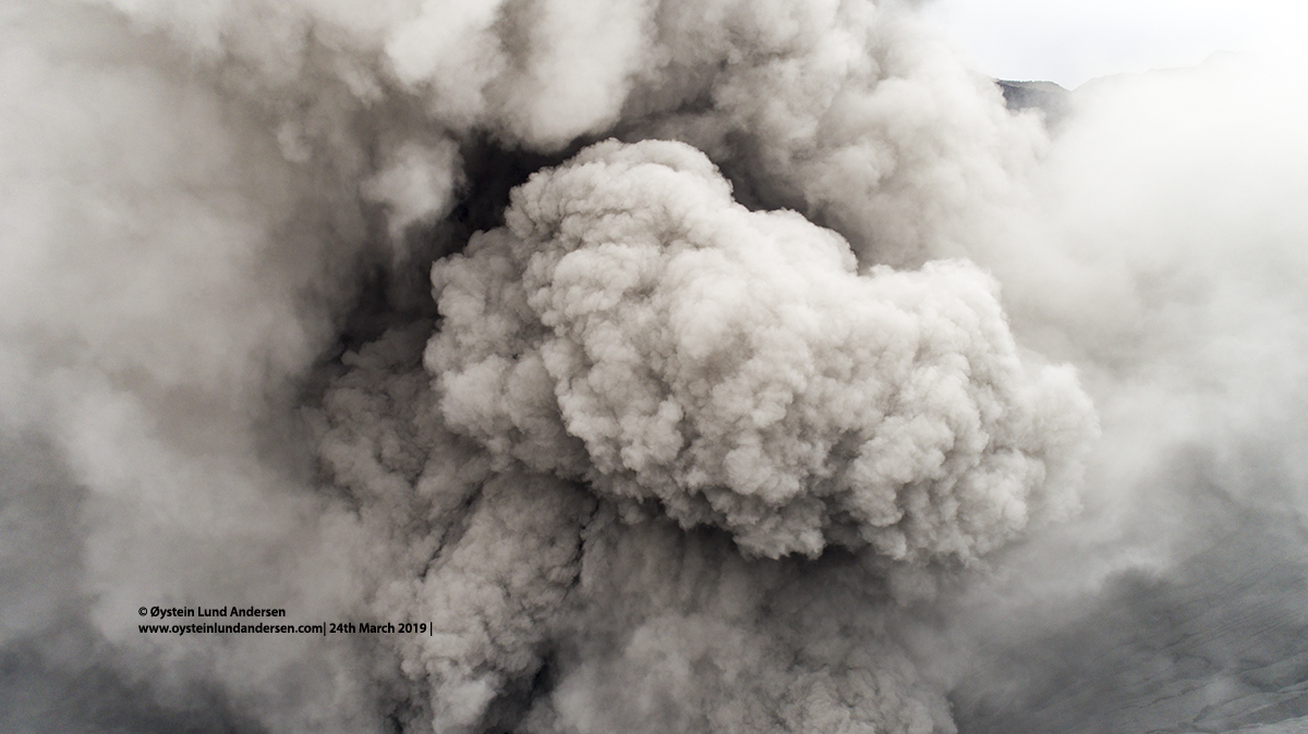
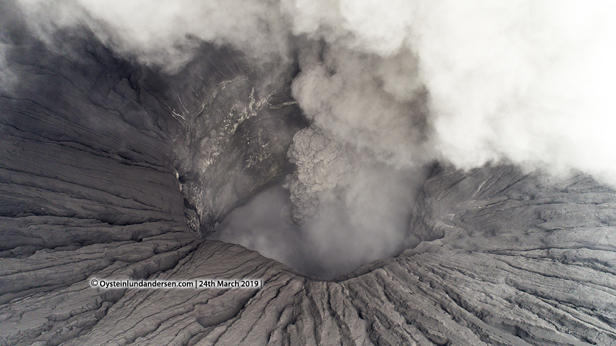
Photo 1. Long exposure photo captured during night, at around 01:00 local time. (23th March 2019)Photo 2. (23th March 2019)Photo 3. The area was covered in fog in the morning, but the ash-cloud from Bromo was visible above the clouds using a drone. (23th March 2019)Photo 4. Ash was drifting N/NE during my whole stay in the area. (23th March 2019)Photo 5. Close up of the crater. It was difficult to get a clear view of the floor of the crater because of the continious ash-venting. (23th March 2019)Photo 6. (23th March 2019)Photo 7. Ash-rich plume from Bromo releasing ash over the seasand caldera (23th March 2019)Photo 8. (23th March 2019)Photo 9. (23th March 2019)Photo 10. (23th March 2019)Photo 11. (23th March 2019)Photo 12. (23th March 2019)Photo 13. (23th March 2019)Photo 14. Bromo (Cender-left) Batok cone (right) Segera Wedi (behind Bromo) and Semeru volcano in the far background. (23th March 2019)Photo 15. (23th March 2019)Photo 16. (23th March 2019)Photo 17. (23th March 2019)Photo 18. Some eruption pulses were stronger than others and sent the ash higher. (23th March 2019)Photo 19. (23th March 2019)Photo 20. (23th March 2019)Photo 21. Bromo seen from the edge of the Seasand/Tengger Caldera. (23th March 2019)Photo 22. (23th March 2019)Photo 23. (23th March 2019)Photo 24. Looking up at the ash-cloud using the drone. (23th March 2019)Photo 25. (23th March 2019)Photo 26. (23th March 2019)Photo 27. (24th March 2019)Photo 28. (24th March 2019)Photo 29. Looking straight down into the crater. (24th March 2019)Photo 30. (24th March 2019)Photo 31. (24th March 2019)Photo 32. (24th March 2019)Photo 33. Some trees in the area had collapsed from the weight of the ash. (24th March 2019)Photo 34. (24th March 2019)Photo 35. Again, it was hard to spot the crater floor as constant ash was erupted. (24th March 2019)Photo 36. (24th March 2019)Photo 37. One of my first shots that revealed the crater floor. It seem to be covered in a mixture of ash and water. (24th March 2019)Photo 38. Close up of the ash-plume. I did fly trough the edge of the ash-plume a couple of times by mistake, luckily the drone survived it. (24th March 2019)Photo 39. Most clear photo of the crater, showing clearly the fissure involved in erupting ash. (24th March 2019)
Photo 40. (24th March 2019)
Photo 41. (24th March 2019)Photo 42. (24th March 2019)Photo 43. (24th March 2019)Photo 44. Bromo in front of a riverbed that drains rainwater and lahar at times. (24th March 2019)Photo 45. Bromo, red-car (center) gives a perspective. (23th March 2019)Photo 46. (24th March 2019)Photo 47. The village of Cemara Lawang with Bromo in the background. The village had been affacted by ashfall, however only mildly so far. (24th March 2019)Photo 48. (24th March 2019)Photo 49. (24th March 2019)