Visiting the area on the 22-23th February, two weeks after the major (VEI-4) eruption of 14th February. Visited the Volcano observatory (PVMG) on the 22th February, and they indicated that the activity-level was decreasing.
Approached the Volcano from Kediri side, did not venture, or have the intention of visiting the crater area, as this was off-limits.
The highlight of the visit, apart from: visiting the volcano observatory and seeing the impacts on the eruption, was meeting a local-resident who claimed he was the first person to visit the Volcano after the eruption, and he had taken photos. Suwarno told me that he normally works as a photographer at Kelud Volcano, earning his living of taking family-style photos of people visiting the Volcano. He claimed he visited the crater 5 days after the eruption (18th February). Police also confirmed to me that Suwarno really went to the crater area, as they had catched him on his way down. His two photos are posted below. Posted with permission from Suwarno.
Other impressions:
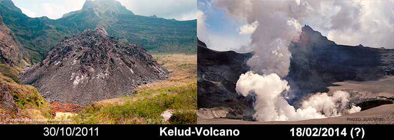
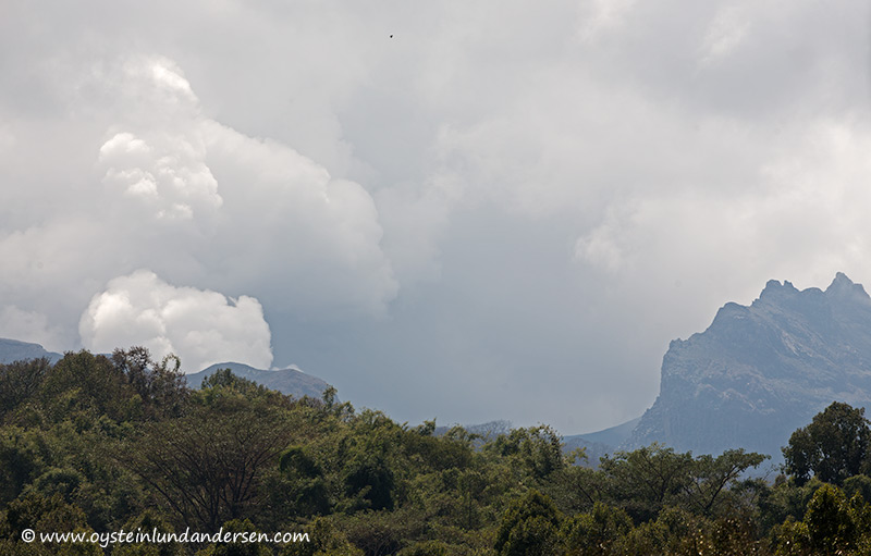
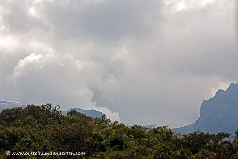
Suwarno`s photos show that the lava-dome was displaced during the eruption (see photo comparison/nr.0, where I have combined one of my own photos from 2011, with Suwarno`s photo of 18th February), and a crater vent has appeared at the spot where the old-lava-dome was before the eruption. One of Suwarno`s photos also show that the volcano was degassing accompanied by ash-venting on the 18th February. The volcano was still showing a degassing-plume during my visit on the 22th February (see photos nr. 1-7)
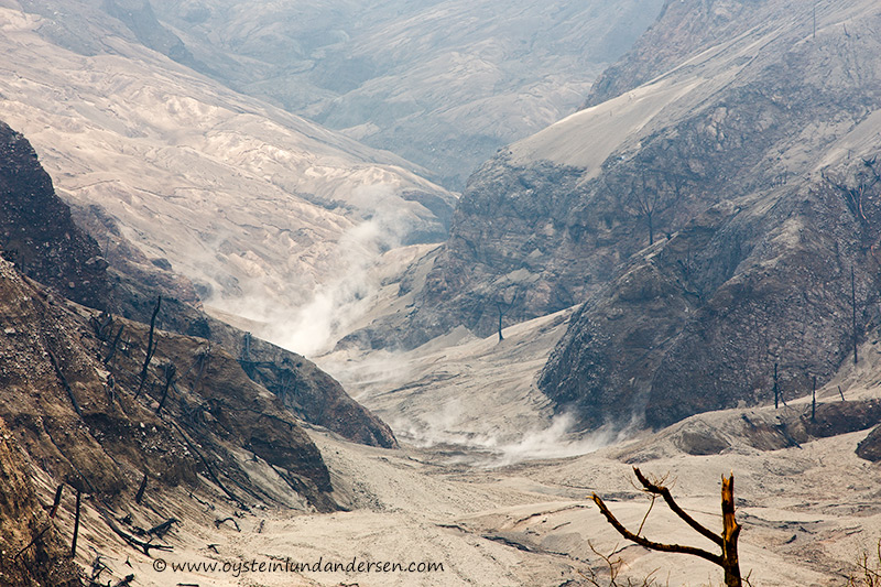
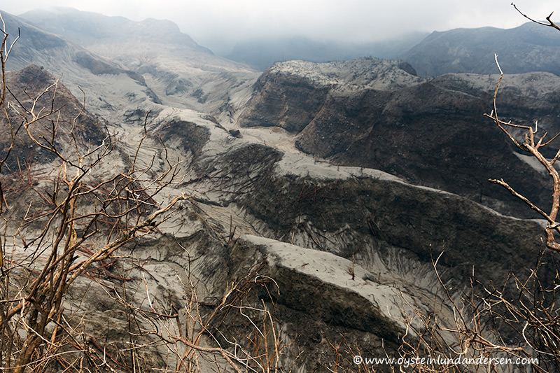
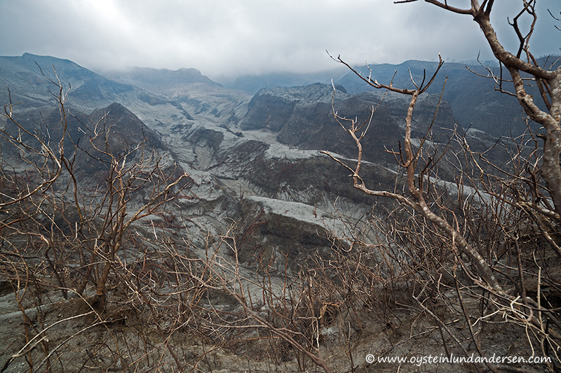
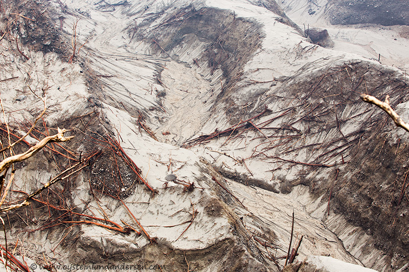
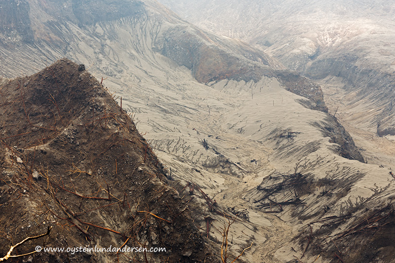
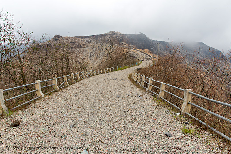
As you approached 2.5km from the crater area, most of the vegetation is destroyed, particularly in the valleys below the crater area (see photo comparison photo nr. 18). Most of the trees are downed, a probable cause might well be pyroclastic flows/deposits. (see photos nr. 11-13, 15-21) Some valleys just below the crater-area (example: see photo nr.13) show pyroclastic material (or lahars?) that was still steaming during my visit.
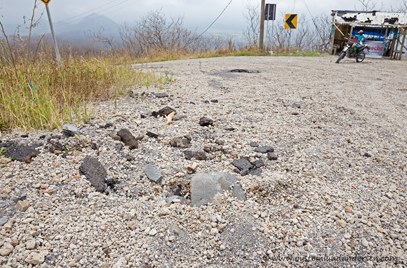
From 3km and nearer you would see more volcanic-blocks that might as well be pieces of the lava-dome (see photos nr. 23-24)
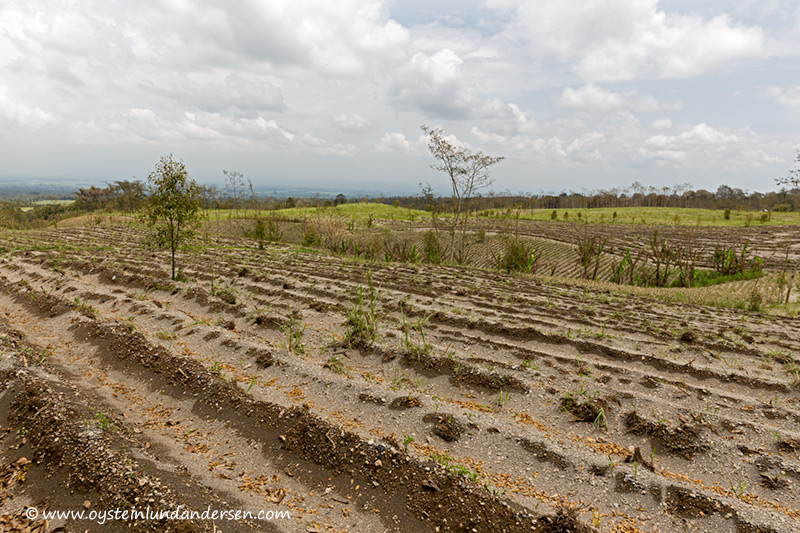
From 2-7km from the Volcano, there was much more lapilli sized fragments than ash (see photo nr. 23-26). On distances more than 7km away from the crater-area, you would find more ash deposits, it seemed.
It was interesting to note that not much ash was deposited on the (western) flank of the Volcano. This could be explained by the fact that most of the ash was propelled into great heights and was dispersed further away from the Volcano, as we know it much ash was distributed in the areas west of the Volcano, also to far distances (central-java etc..)
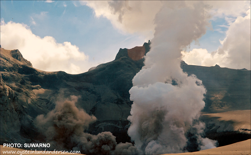
Photo by Suwarno. According to Suwarno, this photo was taken on the morning of the 18th February 2014. Possibly the first photo taken of the Kelud-crater area, since the eruption on 13th February 2014. The photo show that the eruption displaced the lava dome, that was present before the eruption.Photo by Suwarno. One of his photos show degassing accompanied by Ash-venting from the crater.Photo. nr 0. See photos from 2011 of the lava dome: here
22 February 2014.
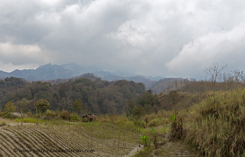
Personal photos taken on the 22th February, from the Western-flank of the Volcano.
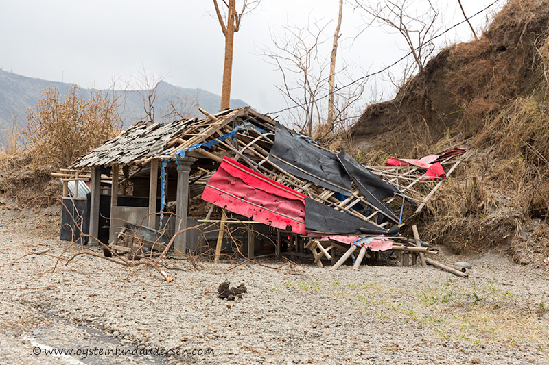
Photo nr. 1. Kelud seen from the PVMG Volcano observatory. 5km from the crater-area. (22th February -11:14 local time)7. (22th February – 10:18)6. (22th February – 10:14)5. (22th February – )4. (22th February – 10:06)3. (22th February – 09:59)2. A pulsating steam plume was present most of the day. (22th February -09:49)8. Agrilcultural Field impacted by lapilli. Interestingly not much ash was present so close to the crater. (5km from the crater area) (22th February – 10:57)9. Ash and lapilli (5km from the crater-area)10. Agricultural lands on the western slope of the volcano. (5km from the crater area) (22th February – 11:14)11. (Approximatly 3km from the crater area) (22th February – 11:28)12. The area seems heavily impaced by the eruption, especially the area in the deeper part of the valley, that seems to have been impaced by pyrolcastic flows. (22th February – 11:57)13. Steaming pyroclastic flow deposits (or hot lahar flows?), in one of the Valleys below the crater area. (Area lies +/- 1km SW from the crater area.) (22th February – 11:57)14. The asfalt road is covered by lapilli (pumice) and larger volcanic material. (approx. 3km from the crater-area)15. Valleys leading up to the crater area, most trees have been downed and the vegetation is covered in volcanic-deposits. (22th February – 12:02)16. A lot of volcanic material are deposited on these slopes, and trees have been downed by pyrolclastic flow deposits (and/or other elements of the eruption) (22th February – 12:03)17. 2km from the crater area, and everything has been burnt or covered by deposits. (22th February – 12:04)18. Comparison of the western-flank, photo of 2011 vs february 2014. The vegetation has been destroyed due to the brutal forces of the 14th February eruption. Most of the trees has collapsed and the parking- and recreation area seen on the top left of the 2011 photo is gone. Download larger resolution photo: here19. (22th February – 12:05)20. A lush green forest once stood here, now covered by deposits from a pyroclastic flow? (22th February – 12:05)21. (22th February – 12:05)22. Tourist-shop heavily bombarded and partially collapsed, by volcanic material.(approximatly 2.5km from the crater area) (22th February – 12:08)23. Among the Lapilli and volcanic-bombs, there was also a lot of volcanic-blocks, like these ones, and it might as well origin from the displaced lava-dome and/or cold-material from the re-making of the crater.24. The volcanic-blocks are heavy, on this photo it has penetrated the asphalt of the road. (2km from the crater area) (22th February – 12:11)25. Lapilli-sized pumice on the table of one of the former shops along the road to Kelud.26. Road to Kelud, covered by volcanic rocks (mostly pumice, but also volcanic blocks) (Approximatly 2km from the crater) (22th February – 12:12)